OOKLA 5G MAP
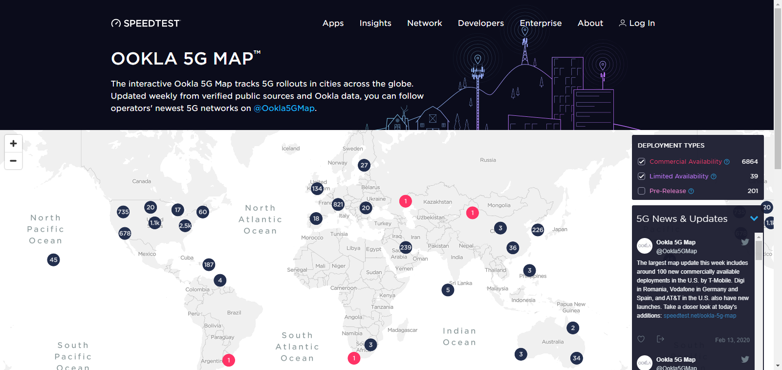
The interactive Ookla 5G Map tracks 5G rollouts in cities across the globe. Updated weekly from verified public sources and Ookla data. Tip: check “Pre Release” box to see networks about to launch.(5G rollouts in cities across the globe)
Mobile IoT Deployment Map
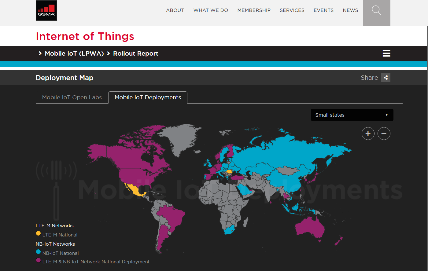
https://www.gsma.com/iot/deployment-map/
Mobile IoT networks being rolled out around the world. Information on operators, equipment manufacturers and associated technologies that are being developed in any particular region. The map highlights both national and regional deployments of LTE-M and NB-IoT networks, and enables companies looking to deploy Mobile IoT solutions to make an informed decision based on availability in their region.
Global Network Coverage Comparison
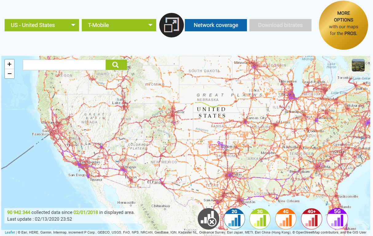
Accurate information for all cellular networks arounde the World, comparing 2G, 3G and 4G mobile networks coverage in several countries.
Cellular Maps
A collection of cellular and wireless coverage and information maps for USA and Mexico. Some maps are alternatives to generally-available maps, hard to find maps, or maps that are no longer available elsewhere. Include: Coverage Comparisons, Licensed Service Areas, 3G, 4G & 5G Coverage, Wireless Spectrum and more.
Submarine Cable Map
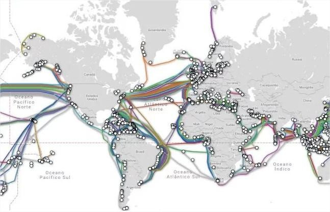
Have you ever thought how it is possible to talk to someone on the other side of the planet?
Because of the use of cell phones it is quite common to believe that data / voice communication around the world is done wirelessly but believe me, only a small part is transmitted in this way. A widely used medium for communication between continents and countries is submarine cables.
That’s right, as the name says, they are cables specially designed to withstand underwater conditions and allow connection to tens up to thousands of kilometers of distance between one point and another.
Although it has been a technique applied since the 19th century, the use of these cables is more advantageous than satellite links, since the climate has no impact on signal transmission and the use of optical fibers ensures greater speed and data traffic.
Wikimapia
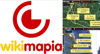
An open-content collaborative mapping project, aimed at marking all geographical objects in the world and providing a useful description of them. It aims to create and maintain a free, complete, multilingual and up-to-date map of the whole world. Wikimapia intends to contain detailed information about every place on Earth.
http://wikimapia.org/ge.kml
Wikimapia Google Earth file.
Get Panoramas
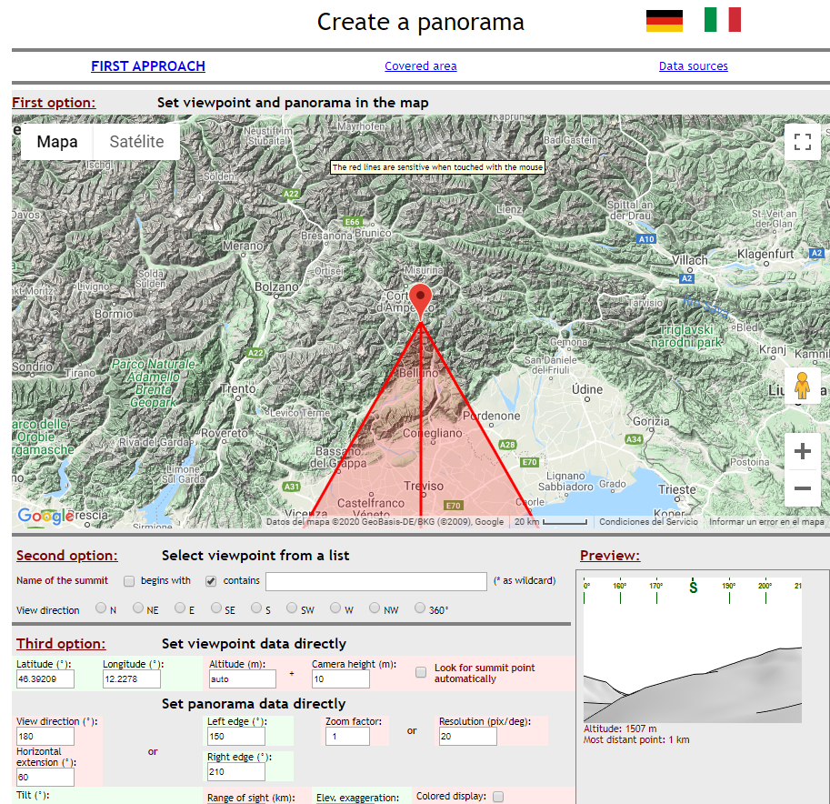
Get panoramas with labelled summits as seen from any point of view in the Alps or elsewhere on the earth.
Suggested by:
https://www.linkedin.com/in/muhammad-usman-22593835/