Here’s a tutorial on how to use Google Earth’s “Viewshed” feature (and I call it 3D Sight). ![]()
This feature allows you to show how much a point (placemark) on the map, with some height set, “sees” in all directions.
Note: It is not a prediction and does not take into account RF effects such as reflection, penetration and so on - only shows the target of sight.
It takes into account both the terrain and the 3D buildings.
Step by step:
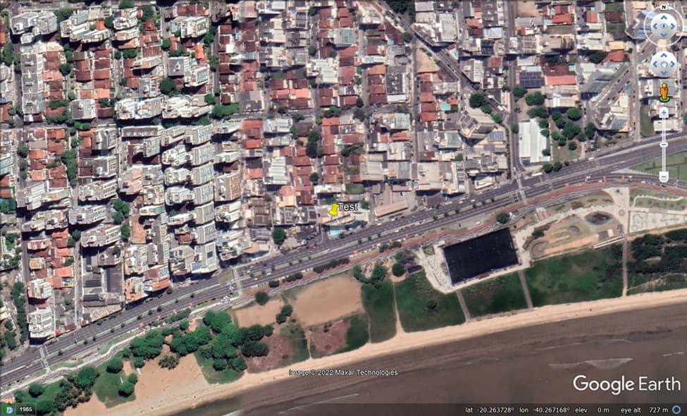
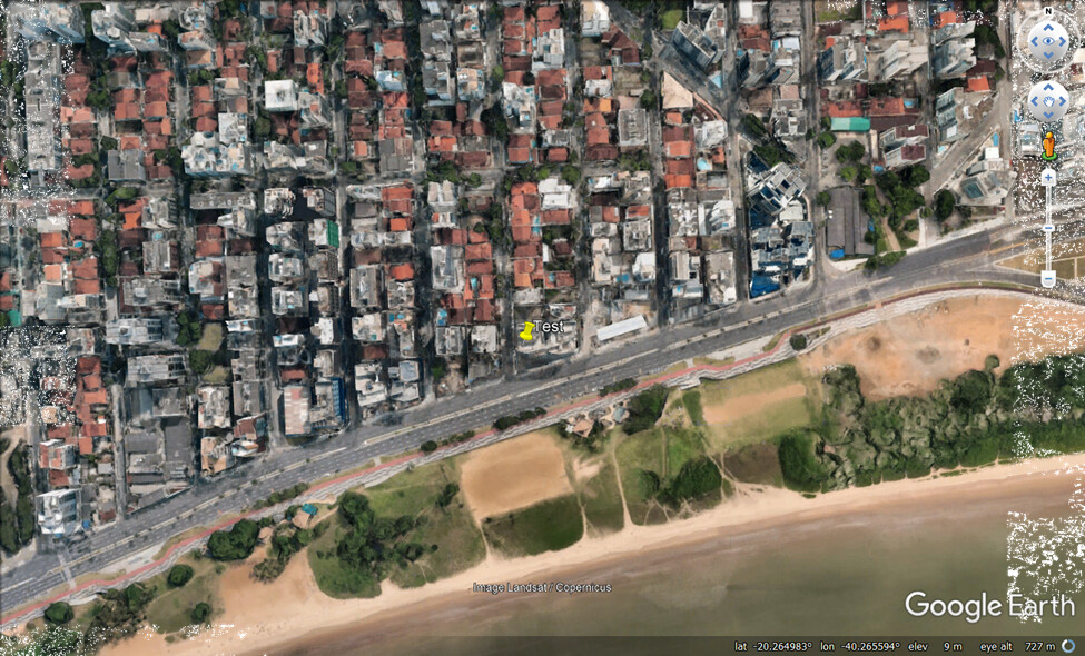
First, let’s add a new placemark (“Test”) in some building.
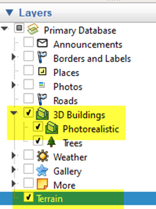
Now, let’s turn on the terrain Layer (and also – optionally - 3D Buildings Layers if you want):
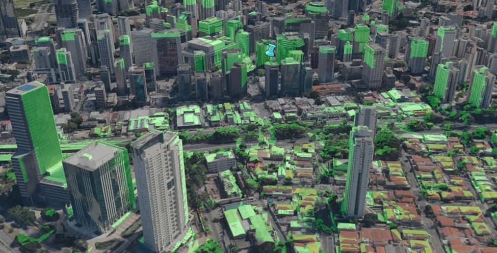
As we can see, 3D Buildings made our Placemark almost disappear.
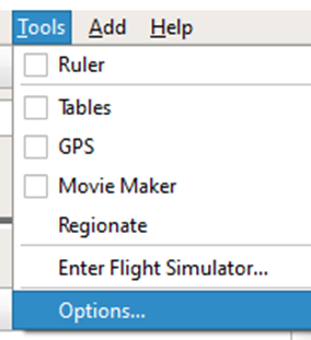
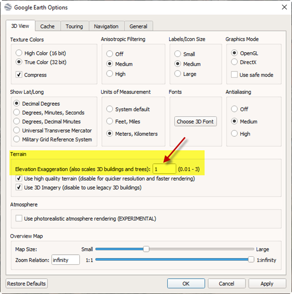
So, let’s ensure that the terrain is in the original proportion, by accessing Options, in Tools Menu.
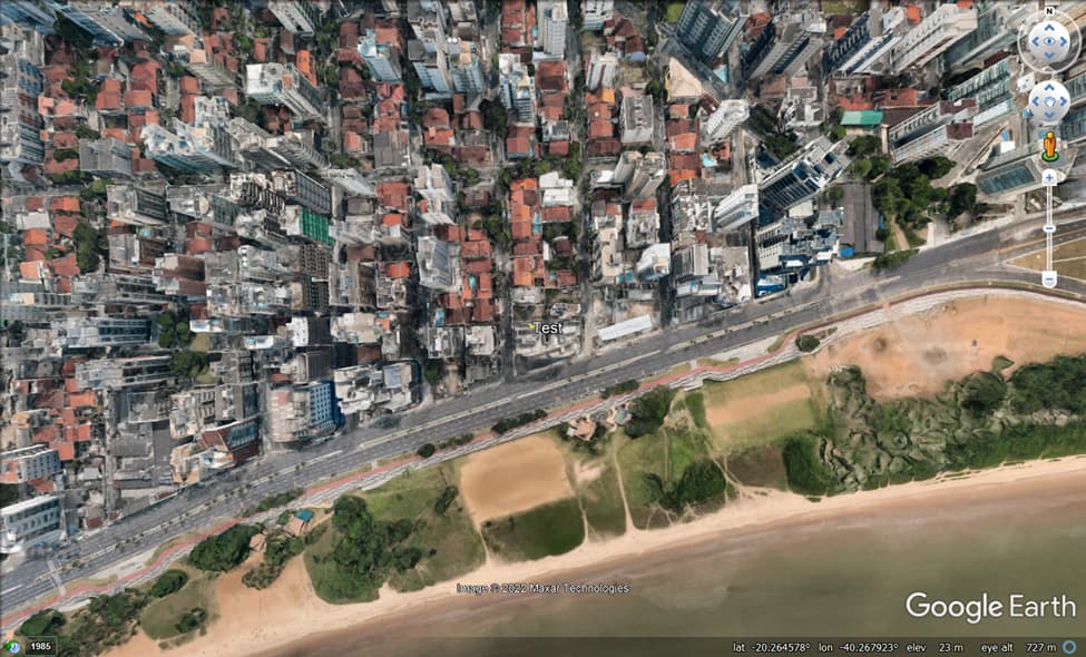
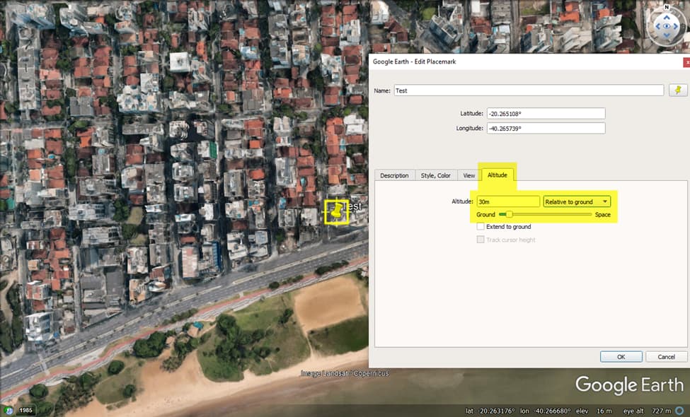
Now we can see our Placemark now above the Building.
In 3D View tab, set Elevation Exaggeration equal “1”.
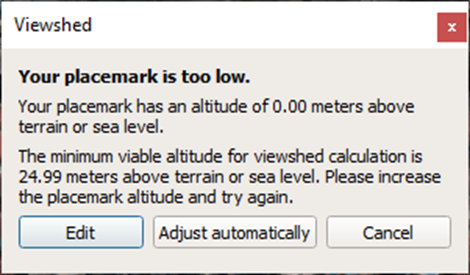
Continuing, let’s set the height of the point to be analyzed. Let’s say this point has height equal to 30 m, “Relative to the Ground”.
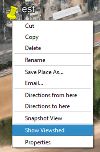
Again, right click Placemark, but this time choose “Show Viewshed”.
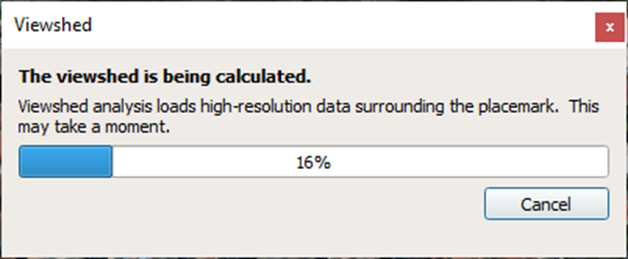
Now, wait till Google Earth calculate the viewshed.
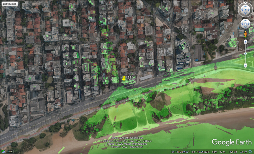
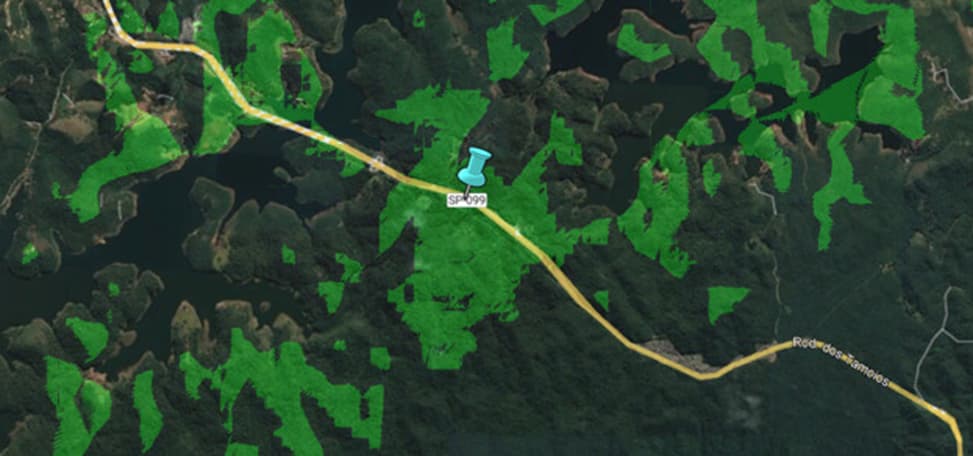
Now you can see the viewshed: green area in map.
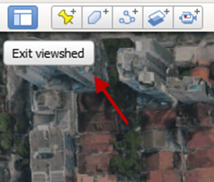
To close the created layer just “Exit viewshed” button.
Following, some more examples.
Example 1: Greenfield Simulation
- Point on highway with very irregular terrain.
- 50 meters height.
- Terrain Layer ON, 3D Buildings Layer OFF.
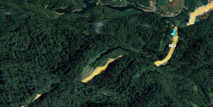
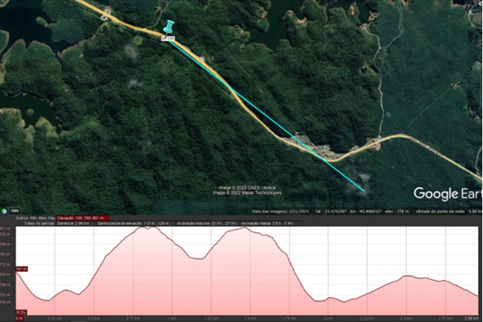
The green area “theoretically” has no terrain obstructions. And from any point inside green area it is probably possible to “see” the placemark.
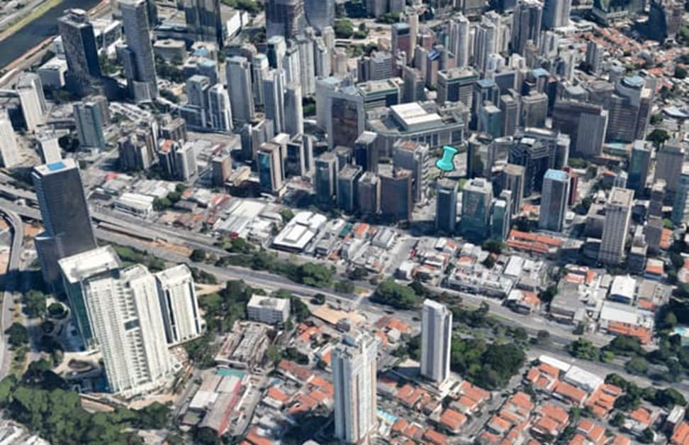
Example 2: Rooftop Simulation
- Point in dense urban area.
- Height set over the building.
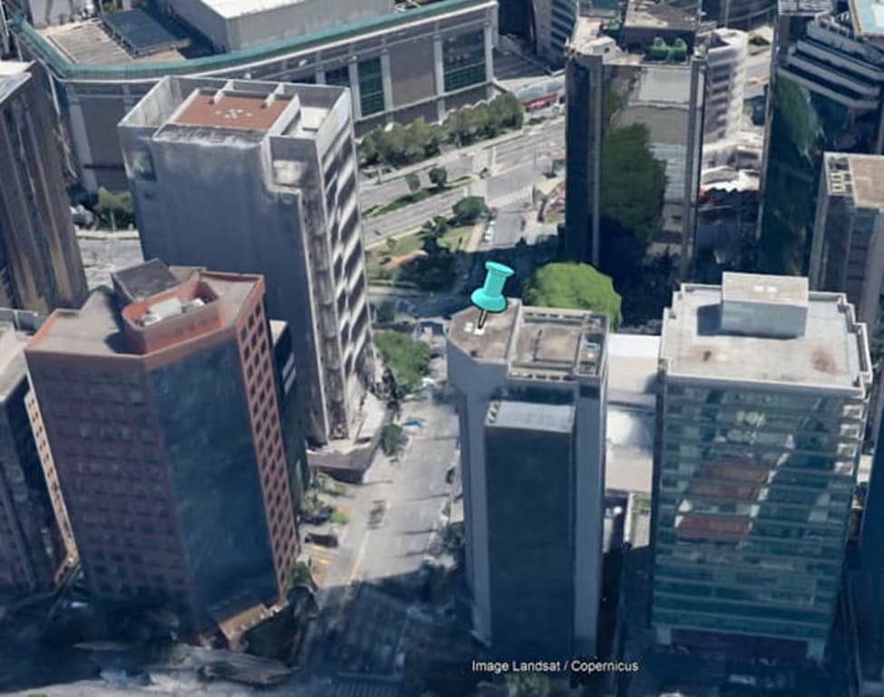
- To get a sense of the height that Google considers in the building:
-
Hover the next street, write down the terrain level.
-
Repeat the process at the top of the building.
-
Calculate the difference.
-
Eventually Google will tell you if you need to adjust (put about 2~3 meters more of the suggestion to simulate a mast).
-
Terrain Layer ON, 3D Buildings Layer ON.
-
- To get a sense of the height that Google considers in the building:
And you can see viewshed.
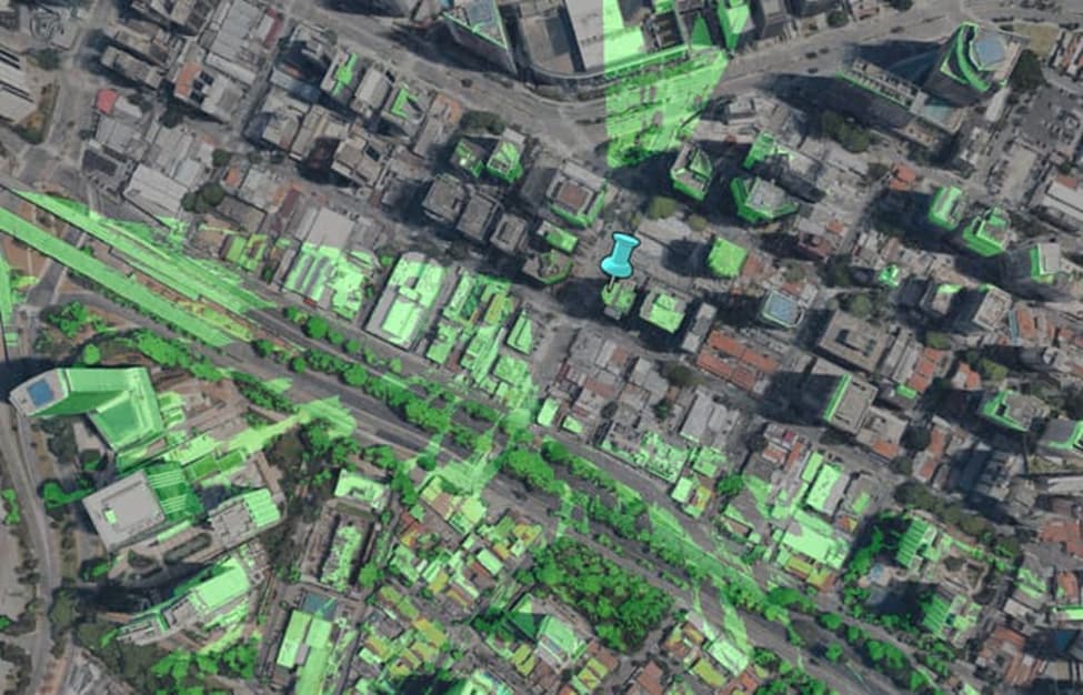
As you can see, it’s a very cool tool for defining new sites, evaluating possible obstructions in complaints and the like.
And if you like Google Earth and Site Survey, you may also like to see these tutorials: