Introduction
Hello! A few days ago, I published an article about an online planning tool for RF. Today, I return to the same subject, with a new tool, now in the area of Transmission (PDH, SDH…).
The software is entirely online, hence the advantages of this type of implementation: access from anywhere with a username and password, standardization of procedures, etc…
This only makes me believe that this is the path to which are going all software. Be RF Planning, Transmission or any other that we use in IT & Telecom.
Seeing as Google is developing in this direction (Google Docs), we have one more factor to at least know the potential of these tools.
Author of the Tip
I received this tip from Rogerio, then here comes his contact info:
-
Rogerio Vieira Leiva
-
Telecommunications Engineer
-
Again, Thank you Rogerio!
What is a Transmission Tool?
It s a tool, or program for assessing the condition of the wireless link, ie whether it will work with specific heghts and antennas locations.
These tools rely heavily on the accuracy or quality of information on the Environment, Land and Equipment.
The program that we know today takes this into account. PtP, from Alphimax.
The Program Site
The site for direct access to our tool today is:
http://www.alphimax.com/ptp/overview
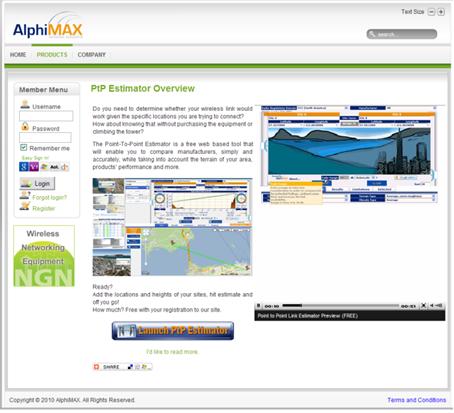
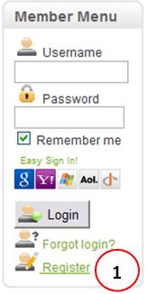
It’s very intuitive, and to get started, simply create a username and password for free. Simply click on Register (1) on that page.
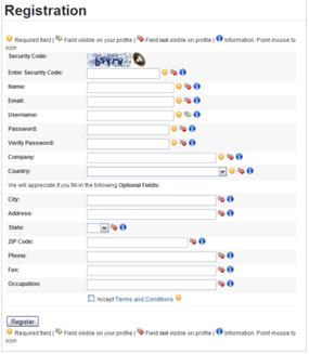
Fill out the registration form with your details, as any registration. Wait to receive an email to confirm your account and you’re done. Now you can start.
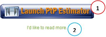
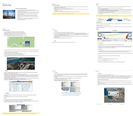
Well, back to the homepage, you have two options - apart from reading an introduction to the program and be able to watch a video in point: access the program directly (1) or read a good step by step available (2).
As the program must be new to you, I advise reading this introduction. There are 9 brief summaries of the main specifications of the program:
http://www.alphimax.com/ptp/getting-started.
(I will not be repeating information here once it’s clearly written by the program developer team). After reading the introduction, you can then login and access the program main page.
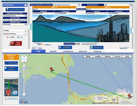
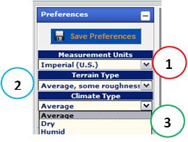
In the upper left, you set your preferences. You can adjust your Measurement Units (1), the Terrain Type (2) and also the Climate Type of the link (3). For example, in Climate, you can choose between medium, dry or wet.
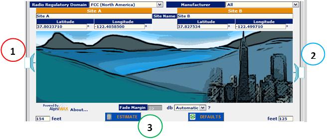
In the top center, you have a graphical representation of link (A - B). In addition to other adjustments as Fade Margin, it is interesting the interactivity to change the heights of antennas: just click and drag with the mouse (1) and (2). When all data are properly adjusted, then you click Estimate (3) and the link is estimated.
Now at the bottom, you can have several other options. Each can be accessed by the corresponding tab.
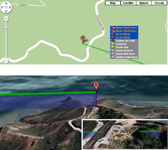
On Main - Map (1) - you have the option of moving the sites A and B. For this, simply click and drag the point (2) - the same way as you work with Google Maps. Incidentally, speaking of that, the program uses the Google Maps API, which makes it even more interesting, since the quality of these maps is a fact.
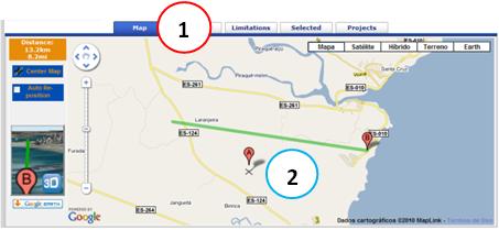
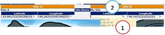
Of course you must have your existing sites. And for that, you can enter the exact coordinates (1) and even to change the name of your it (2).
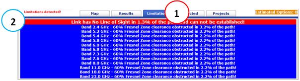
The flap Limitations (1) lets you check cases where your link has obstructions. Note that in this case, also flashes a red text with ‘Limitations Detected’ (2).
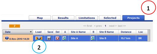
The Projects tab (1) keep all your projects executed. You can for example load (2) an existing project.
Anyway, this was a brief summary, I have not spoken to some other few points because the tutorial already stretched too much, and can be found in more detail in step by step recommended above.
There is no better way to learn than by doing so, I recommend you create your user, and test yourself! ![]()
Of course, the same way as other software programs online today, we still have a certain ‘resistance’ to use them. But if we think of using them ‘too’, without divesting the traditional programs offline, you have some advantages, such as the possibilities of benchmarking. In addition, programs such as the PtP Estimator from Alphimax already bring us ‘ready’ Terrain, Environmental Propagation and Products.
Of course there are always those who are against, who is in favor, and those who prefer to wait and see what happens. Only in this case, perhaps those who fail to follow this path may end up falling behind.
And you, what do you think? I await your comments below, ok? ![]()
Conclusion
This was a brief summary of the online tool PtP Estimator of Alphimax - an online tool that aims to meet all the needs of a Design of a Transmission Link.
Again, a new concept. Worth evaluating.
We hope you’ve enjoyed. If you have any doubts, find the answers posting your comments in the blog or email.
Till our next meeting, and remember: Your success is our success!