Hi All.
Does anyone know the difference between 2.5D map and 3D map in planning?
Hi All.
Does anyone know the difference between 2.5D map and 3D map in planning?
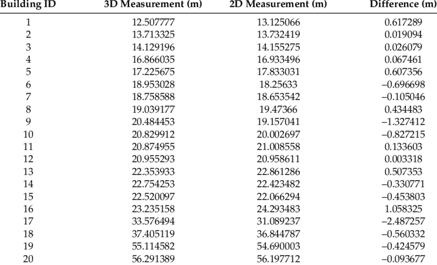
Here you can see a table:
Basically 3D maps useful to plan sites to cater traffic from high-rise buildings, it can be useful with geo location tools from where we can get exact location of users vertically in high-rise/skyscraper buildings. For example with accurate data operator can put antenna at desired floors.