Hello,
This is the download page for the module Hunter Lite - KML Plotter.
Download
To Download (and use) the Hunter Kml Plotter, click the link below.
Download Link:
Hunter_KmlPlotter_160713d.zip (107.6 KB)
Tutorial
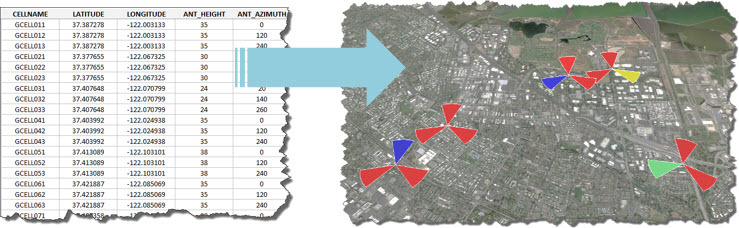
If you work with telecommunications, it is very likely that already has come across the following request: generate a map in Google Earth (kml file) from a table with latitude, longitude and some other basic information.
This task may seem simple, but if you’ve tried to do it, probably realized that it is not as easy as it sounds!
Many people don’t even know where to start: ask for a friend to help, do a good ‘Google Search’, among other efforts.
What happens is that as this is a secondary activity, and that is not part of our routine or scope, ends up being difficult to find any tool or straight macro, to just do what you need in a quick and easy way.
For this reason, we at telecomHall create a generic Hunter module, the ‘Kml Plotter’.
If you match the profile of those who need or may need such a tool, we invite you to download, and use it at your will. And above all: we count on your comments and suggestions - always welcome.
Goal
The purpose of this tool (‘Hunter Kml Plotter’) is to provide a quick result whenever there is a need to transform tabular data to the Google Earth format (kml).
The design possibilities in Google Earth are very large (colors, sizes, shapes, etc.). Moreover, for each specific purpose there is always a more “detailed” solution, which is more closer to desired/expected result.
To keep the tool straight and efficient, we try to keep a very ‘clean’ and intuitive interface in general, but without losing its essence as ‘quick help’.
This tool is always evolving, a constant process of improvement and mainly based on feedback and comments from users. Note: It is possible that soon the tool you download will not have this ‘appearance’. This is because, as already mentioned, the future of it will be guided by users - including its appearance.
We hope that you enjoy the tool, and also participate by helping to shape its roadmap (new features, etc.).
Versions and Help
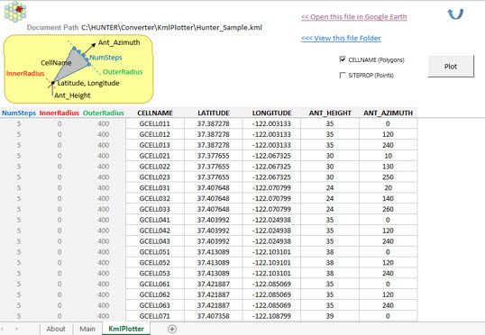
In its original version, the Hunter KML Plotter have two plot options:
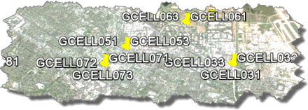
Points: for example used to indicate a Site Property, or physical location where the equipment are (Base Stations) are.
Polygons: cone-shaped (petal) or semi-cone cells (by varying inner and outer radius in the table). For example, to represent the cells of a 2G-3G-4G network.
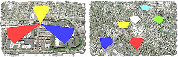
The different coverage areas for different network cells can be adjusted - changing the values of the external and internal radius of the cell.
Conclusion
The tool available here allows anyone to make their own plots data in Google Earth.
Staring from a simple table, with basic latitude and longitude information, you can, quickly and easily, generate a Google Earth file (kml format), ie with georeferenced data.
Thus, most of the time can be allocated to analysis. The generated files allow a more simplified analysis, a more ‘direct’ view of the network topology, enabling a much more precise correlation among problems and whre they occur.
We also started here a new development phase. For this specific tool, where we’ll try to improve based on users comments. And also for other tools and resources, geared for increased use in our large telecom community. After all, this has always been our goal!
Thank you for visiting, we hope your comments, criticisms and suggestions.
